Cottonwood Pass South
| Trail Features: | Outstanding Panoramic Views | 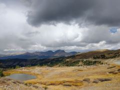 |
|||
| Trail Location: | Cottonwood Pass | ||||
| Roundtrip Length: | 5.2 Miles | ||||
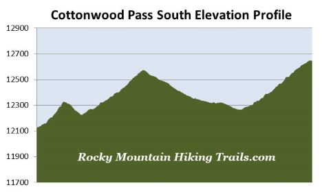
| Trailhead Elevation: | 12,126 Feet | ||||
| Total Elevation Gain: | 1245 Feet | ||||
| Avg. Elev Gain / Mile: | 479 Feet | ||||
| Highest Elevation: | 12,650 Feet | ||||
| Trail Difficulty Rating: | 7.69 (moderate) | ||||
| Parking Lot Latitude | 38.82771 | ||||
| Parking Lot Longitude | -106.40935 | ||||
Trail Description:
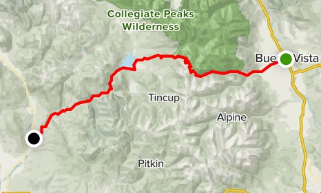
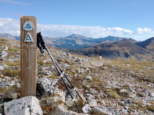
The Cottonwood Pass South hike begins from Cottonwood Pass, located 18.9 miles west of Buena Vista, Colorado. As the name would imply, the hike travels south from Cottonwood Pass, and will follow the Continental Divide Trail (CDT) and the Colorado Trail (CT) to reach Wander Ridge, the end point for this hike.
At just over a tenth-of-a-mile from the pass the trail will reach a side path that leads to “Summit Viewpoint”. Although you don’t have to take this short side trip, as you’ll have similar but much better views later on, we took the spur leading to the summit. At one-quarter of a mile the summit of this low-lying mountain is attained. This is a fairly popular destination for tourists passing through the area, so it may be crowded at times. After soaking in the magnificent views simply return to the trail split (there are several signs in this area asking people to stay on the trails) and continue along the CDT / CT. This side trip adds just over two-tenths of a mile to the overall mileage, which is included in this hike description.
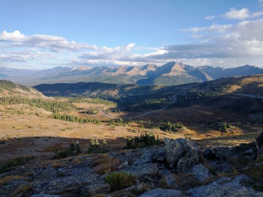
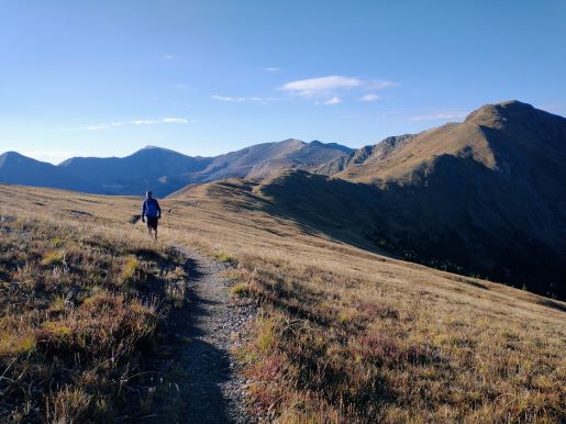
From the split the trail skirts around the west side of the mountain, while the route up to your next destination almost immediately becomes visible. After traversing across the saddle on the back side of “Summit Viewpoint” the trail begins to ascend the northeastern slopes of a mountain simply referred to as Point 12,580. At roughly 1 mile from the trailhead hikers will reach the summit of this peak where you’ll enjoy spectacular 360-degree views. From the top you’ll be able to see numerous mountains in the Collegiate Peaks and Sawatch Range, as well as Taylor Park Reservoir and the Elk Mountains in the far-off distance towards the west. At the summit there’s a fairly large wind break should the weather turn south during your trip. Hikers should note that this entire route travels across alpine tundra, thus you’ll be exposed to all of the elements during the entire trip.
From Point 12,580 the trail continues southward by following the ridgeline to the next mountain, known as Wander Ridge. Much of the route along this hike traverses along the Continental Divide, which also marks the boundary between the Gunnison National Forest to the west, and the San Isabel National Forest to the east.
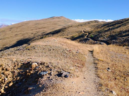
After descending along the southern ridge of Point 12,580, the trail crosses over the saddle between the two mountains and immediately begins ascending the eastern slopes of Wander Ridge. At roughly 2.7 miles hikers will reach the top of the southern ridge extending off Wander Ridge. This is the end point for this hike. From this spot you’ll again enjoy outstanding panoramic views. Directly below, on the east side of the divide, is Lost Lake, which is notable for the small island dotting the middle of it.
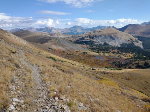
From this vantage point you’ll have a couple of options if you have the time and energy, and wish to explore more of the area. The main trail continues southbound – all the way to Mexico! You could also make the off-trail ascent to the summit of 12,792-foot Wander Ridge, which would entail roughly 140 feet of climbing from this point.
Hikers should be properly acclimated to higher elevations before attempting this hike. You should also be aware of lightning risk while hiking at higher elevations. As a general rule of thumb you should plan to be off the summit before noon in order to avoid the notorious afternoon thunderstorms that frequent the mountains during the summer months. Hikers should also be prepared for extreme sun exposure, wind, cool temperatures, and rapidly changing weather conditions while on the trail. Make sure you have the proper gear with you, and know what safety precautions you need to consider beforehand.