Peak 12,150
| Trail Features: | Outstanding Panoramic Views | 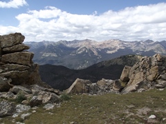 |
|||
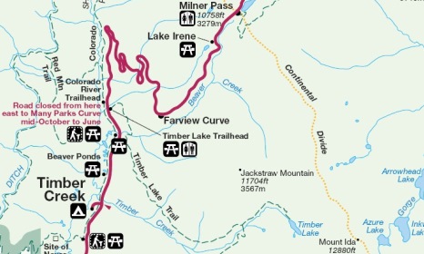
| Trail Location: | Milner Pass | ||||
| Roundtrip Length: | 5.6 Miles | ||||
| Trailhead Elevation: | 10,759 Feet | ||||
| Total Elevation Gain: | 1410 Feet | ||||
| Avg. Elev Gain / Mile: | 504 Feet | ||||
| Highest Elevation: | 12,150 Feet | ||||
| Trail Difficulty Rating: | 8.42 (moderate) | ||||
| Parking Lot Latitude | 40.4203 | ||||
| Parking Lot Longitude | -105.8114 | ||||
Trail Description:
The hike to Peak 12,150 in Rocky Mountain National Park begins from the Poudre Lake Trailhead at Milner Pass, located 15.7 miles north of the Grand Lake Entrance, and 4.2 miles south of the Alpine Visitor Center.
 Peak 12,150 is the moniker for an unnamed mountain along the Continental Divide between Milner Pass and Mt. Ida. Since geographers haven't officially named it, these mountains are simply known by their summit elevations on trail maps. Generally speaking, mountains only receive names when they are considered to be independent from surrounding mountains, as measured by their "topographic prominence" and their isolation from higher summits. In the contiguous United States a peak must have at least 300 feet of prominence to qualify as an independent mountain. Since Peak 12,150 rises only 160 feet above the saddle between it and Mt. Ida, it's not recognized as a separate mountain.
However, Peak 12,150 is still an outstanding destination for those that don't want to hike all the way to the summit of 12,889-foot Mt. Ida. In addition to being far less strenuous, the trail to Peak 12,150 is well defined and easy to follow. Conversely, the route from the saddle to the summit of Mt. Ida is extremely rugged, and is much more difficult to follow. Additionally, the threat of getting caught out in the open in the event of a thunderstorm is less of an issue as well.
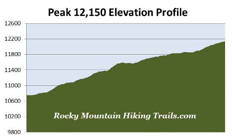
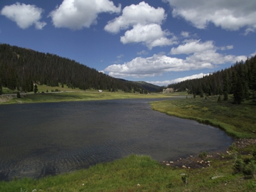
The trail starts off by circling around the southern end of Poudre Lake. Once past the lake it begins climbing through a lush subalpine forest. At just over six-tenths of a mile from the trailhead you'll arrive at the Mt. Ida Trail junction. The trail to the left proceeds towards Forest Canyon Pass. To continue towards Peak 12,150 hikers should turn right here and begin heading southbound.
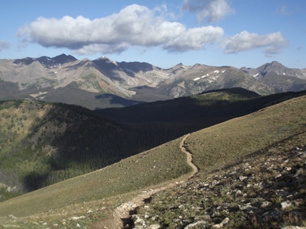 Once past the junction, as the trail climbs higher, hikers will be treated to sporadic views of the Never Summer Mountains towards the west. This range received its name from the Arapaho Indians, who called these mountains Ni-chebe-chii, which directly translates into "Never No Summer". Wishing to avoid the use of a double negative, the U.S. Department of the Interior's Board on Geographic Names settled on Never Summer Mountains. Prior to its official naming the mountains were also known as the Rabbit Ear Range.
At just over 1.1 miles from the trailhead, and an elevation of roughly 11,350 feet, the trail emerges from the tree line and soon reaches the open tundra. From this point forward the route alternates between fairly steep climbs and level terrain. As you proceed higher look for bighorn sheep and elk grazing in the open tundra. The views of the Never Summer Mountains along this stretch are quite spectacular.
Although there are a couple short sections of mild exposure to steep drop-offs along this stretch, the trail shouldn't be considered exceedingly dangerous, at least from my perspective.
At just over 2.8 miles you'll arrive at a fork in the trail, marked by a fairly large cairn. This junction sits near the top of the unnamed mountain known as Peak 12,150. From this lofty perch you'll be able to see Specimen Mountain towards the north, the Mummy Range towards the northeast, Shadow Mountain Lake towards the south, as well as the Never Summer Mountains towards the west. Mt. Ida rises just above the crest in the terrain towards the southeast.
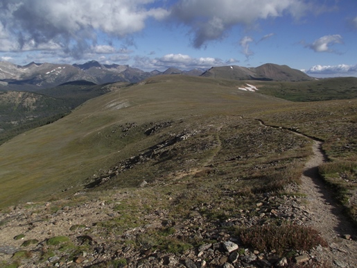
Hikers should note that the junction sits just below the top of the mountain. To reach the actual summit you'll have to turn east and walk cross-country for a short distance to stand atop the highest point on the mountain.
Hikers should always be aware of lightning risk while hiking in the Rocky Mountains, especially at higher elevations. As a general rule of thumb you should plan to be off the summit before noon in order to avoid the notorious afternoon thunderstorms that frequent the mountains during the summer months. Hikers should also be prepared for extreme sun exposure, wind, cool temperatures, and rapidly changing weather conditions while on the trail. Make sure you have the proper gear with you, and know what safety precautions you need to consider beforehand.