
Timber Lake
| Trail Features: | Subalpine Lake, Meadows, Wildflowers | 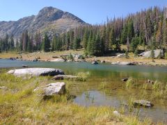 |
|||
| Trail Location: | Timber Lake Trailhead | ||||
| Roundtrip Length: | 10.4 Miles | ||||
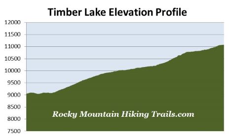
| Trailhead Elevation: | 9050 Feet | ||||
| Total Elevation Gain: | 2120 Feet | ||||
| Avg. Elev Gain / Mile: | 408 Feet | ||||
| Highest Elevation: | 11,080 Feet | ||||
| Trail Difficulty Rating: | 14.64 (strenuous) | ||||
| Parking Lot Latitude | 40.39975 | ||||
| Parking Lot Longitude | -105.8475 | ||||
Trail Description:
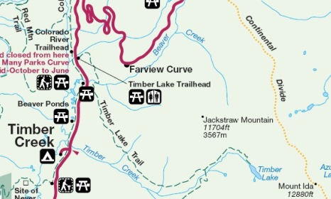
The hike to Timber Lake in Rocky Mountain National Park begins from the Timber Lake Trailhead, located roughly 9.3 miles north of the Grand Lake Entrance, and 10.6 miles south of the Alpine Visitor Center.
Hikers should note that there is an active landslide area along the trail roughly 2.5 miles from the trailhead. As of this writing, the slide area is very short, and shouldn’t be considered a major obstacle for anyone who has moderate hiking or scrambling experience.
The hike begins by passing through a lodgepole pine forest. During our mid-September hike we could hear several elk bugling throughout the woods. The trail climbs steadily as it ascends the western slopes of Jackstraw Mountain. As you proceed up the mountain you’ll enjoy occasional views of the Never Summer Mountains and the Kawuneeche Valley through the trees.
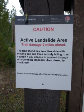
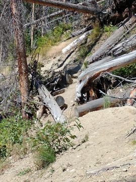
At just under 2.5 miles hikers will reach the aforementioned slide area. This section is roughly 50-60 yards in length, and requires hikers to scramble over and under a few logs, as well as a fairly steep ravine. As mentioned, this section shouldn’t be an issue for most hikers who already have some basic scrambling experience. At this point it’s still an active landslide, so conditions may change. Before your hike you may want to speak with a ranger to find out what current conditions are like for this section.
The landslide began in 2011, which forced the closure of the trail for several weeks. You may be asking why the park hasn’t done anything to improve the situation. My guess is that either they feel they would prefer to allow mother nature run its course, or that any mitigation efforts probably wouldn’t help because mother nature will eventually have its way, or perhaps they believe the existing cluster of downed trees offers a bit of stability, and if they were to remove them they would only exasperate the situation.
At roughly 3.2 miles from the trailhead hikers will pass the turnoff for the Timber Creek Backcountry Campground, and at 3.4 miles will reach the Long Meadows Trail junction. Long Meadows, which extends for roughly two miles, and is known for its abundant wildlife, is located roughly eight-tenths of a mile from this junction. To continue on towards Timber Lake you should turn left here and begin heading up the hill.
Above the junction the trail begins passing along the outskirts of a couple of meadows. Hikers will enjoy great views of Mt. Ida at the second meadow. You should also keep an eye out for elk and moose as you pass through these areas.
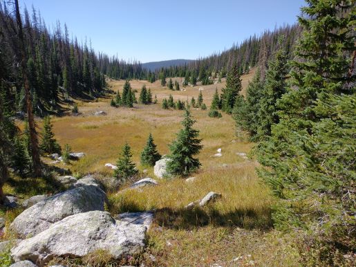
After climbing a few steep switchbacks hikers will reach the top of the climb at just over 4.3 miles. From here the trail traverses through a broad meadow that offers great views of the surrounding landscape. This section travels roughly one-quarter of a mile along mostly flat terrain, before re-entering the forest and climbing once again.
Hikers will finally reach Timber Lake at 5.2 miles. The roughly 10-acre lake lies in a broad basin below 12,889-foot Mt. Ida and 12,504-foot Chief Cheley Peak. Late spring and early summer hikers will also enjoy a plethora of wildflowers in this area. Be aware, however, that snow can also linger at this elevation during this time period.
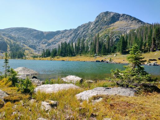
For those who still have the time and energy, there are social trails that lead to the left and right sides of the lake if you wish to explore more of the area.