Horsethief Trail
| Trail Features: | Outstanding Views, Fall Aspens | 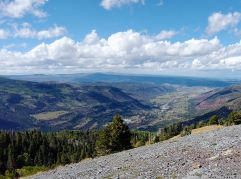 |
|||
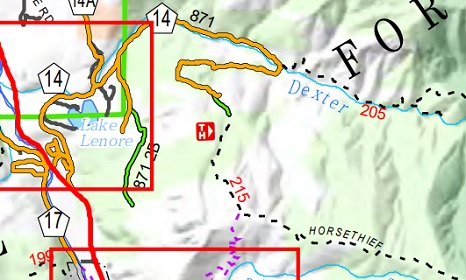
| Trail Location: | Dexter Creek Trailhead (near Ouray) | ||||
| Roundtrip Length: | 6.5 Miles | ||||
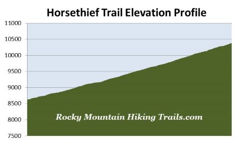
| Trailhead Elevation: | 8629 Feet | ||||
| Total Elevation Gain: | 1760 Feet | ||||
| Avg. Elev Gain / Mile: | 542 Feet | ||||
| Highest Elevation: | 10,385 Feet | ||||
| Trail Difficulty Rating: | 10.02 (strenuous) | ||||
| Parking Lot Latitude | 38.06161 | ||||
| Parking Lot Longitude | -107.66037 | ||||
Trail Description:
The hike along the Horsethief Trail to the so-called “first overlook” begins from the Dexter Creek Trailhead, located just north of Ouray, Colorado. To reach the trailhead drive roughly 2 miles north of Ouray on Highway 550 to County Road 14, and then turn right onto the gravel road leading up the hill. At roughly 0.9 miles from the turnoff you’ll reach County Road 14A. You should bear right here to continue on CR 14. From the junction the road becomes noticeably more rugged. Though a 4WD is preferable, the road is passable for 2WD vehicles as long as drivers take their time and are careful. At roughly 2.4 miles from Highway 550 you’ll arrive at the Dexter Creek Trailhead. From this parking area 4WD vehicles can continue along CR 14 to reach the Horsethief Trailhead, located another 1.25 miles further up the road. This will cut 2.5 miles off the total trail mileage for this hike description.
Both 4WD drivers and hikers in 2WD vehicles should note that you’ll have to cross Dexter Creek at the Dexter Creek Trailhead to proceed towards the Horsethief Trailhead. In spring, or after heavy rain, the creek may not be passable for vehicles; or hikers without getting their feet wet.
After crossing the stream hikers will proceed up CR 14 for roughly 1.25 miles to reach the Horsethief Trailhead. This segment of the hike travels along a moderately strenuous grade. Although you’ll technically be walking along a road, it will feel more like hiking on a wide trail as you traverse through the dense forest. Upon arrival at the Horsethief Trailhead you should turn right to proceed along the standard dirt footpath.
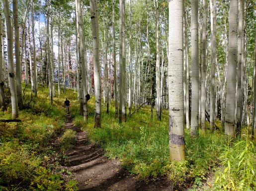
For the most part the Horsethief Trail travels through a very pleasant mixed forest of aspens and evergreens. In some places you’ll pass through sections of mature forests distinguished by some very large trees.
At roughly 2.5 miles from the Dexter Creek Trailhead hikers will begin to enjoy outstanding views of 13,492-foot Whitehouse Mountain towards the west. At 3.1 miles you’ll emerge from the forest where your destination, simply known as the “first overlook,” comes into view for the first time. After ascending a series of switchbacks hikers will arrive at the grassy summit of the “first overlook.” At the top of the pass the trail connects with the Old Horsethief Trail, which travels back down to the outskirts of Ouray.
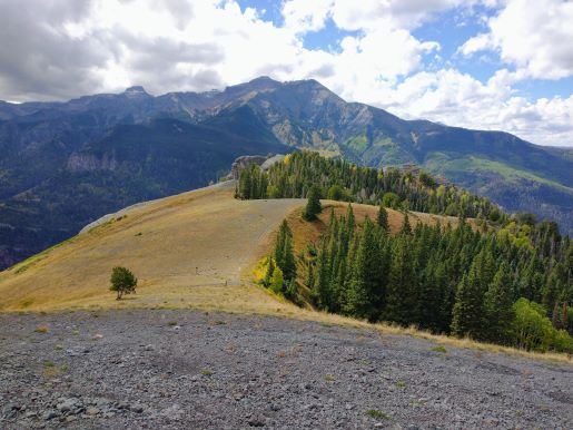
From the overlook hikers will have a few options. If you have the time and energy you could continue for another 2.3 miles (and roughly another 2000 feet of climbing) to reach the Bridge of Heaven. However, if this is your endpoint, I would highly recommend walking up either of the knobs that flank the junction for a much better view of the surrounding terrain. The higher knob lies roughly 100 yards to the east of the junction, and offers stunning 360-degree vistas.
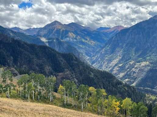
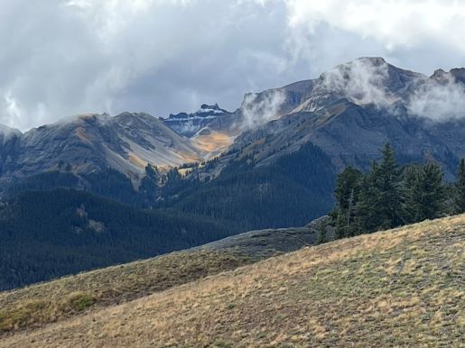
From this vantage point hikers will enjoy commanding views of Whitehouse Mountain, portions of the Sneffels Range, the Yankee Boy Basin area, as well as Red Mountain and the peaks surrounding the Million Dollar Highway. Far down in the valley below you’ll also be able to see a small sliver of Ouray.