Upper Lower Loop
| Trail Features: | Outstanding Views, Wildflowers, Fall Aspens | 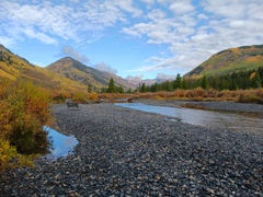 |
|||
| Trail Location: | Peanut Lake Trailhead | ||||
| Roundtrip Length: | 7.1 Miles | ||||
| Trailhead Elevation: | 8880 Feet | ||||
| Total Elevation Gain: | 687 Feet | ||||
| Avg. Elev Gain / Mile: | 194 Feet | ||||
| Highest Elevation: | 9092 Feet | ||||
| Trail Difficulty Rating: | 8.47 (moderate) | ||||
| Parking Lot Latitude | 38.97434 | ||||
| Parking Lot Longitude | -106.99215 | ||||
Trail Description:
The hike along the Upper Lower Loop begins from the Peanut Lake Trailhead on the northwest side of Crested Butte. To reach the official parking area, simply follow Butte Road west until it turns into a dirt road and becomes known as Peanut Lake Road. An obvious parking lot is located on the right side of the road after driving a short distance along the dirt road (you’ll pass an overflow lot before this, just after the paved road ends).
The hike begins by walking northbound along Peanut Lake Road. Hikers may want to note that there’s another parking area located further up this road. Crested Butte has restricted this parking area to people with ADA disabilities and people with small children. So, if you fall into either of those categories, you can cut off 2.3 miles of walking by parking here. I should note that on our return trip we saw numerous people parked along various sections of Peanut Lake Road. I don’t know if this is legal or not, but you may want to check with town officials to confirm this , if you wish to shorten this hike.
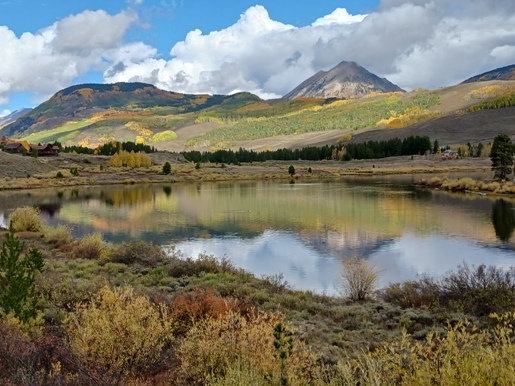
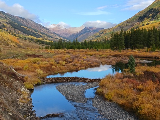
Shortly after starting your hike you’ll begin walking along the west shores of Peanut Lake. 12,162-foot Gothic Mountain will dominate the view above the lake during this stretch. Roughly one-half mile from the trailhead you’ll pass a guillotine-shaped concrete structure known as the “Gronk.” This odd structure was actually part of the old Peanut Mine operations.
At roughly 1.15 miles you’ll reach another local landmark known as the “Alien Shack.” This will be self-explanatory once you arrive here. Just beyond the shack are the restricted parking area and the Lower Loop Trailhead. To avoid some possible confusion, it’s best to continue on the road for another 100 yards or so where you’ll pass a private road branching off to the left. You should continue until arriving at a gate, where you’ll see a trail branching off to the right. You should proceed along this trail. Shortly beyond the gate you’ll reach a split in the trail. Mountain bikers will likely take the single track on the right, while hikers should continue along the wider path to the left.
At 1.8 miles you’ll reach a major junction where the loop portion of this hike begins. To avoid confusion, we followed the loop in a counter-clockwise direction by continuing along the main trail as it heads further up the valley. By this point you will have transitioned from semi-urban surroundings to more of a wilderness area. The views of the surrounding mountains begin to improve as well.
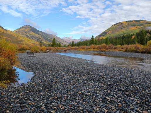
At roughly 2.25 miles you’ll reach a sign indicating that you’re about to enter public lands. Shortly afterwards the trail briefly passes through a wooded area, and then emerges into an open area that offers absolutely spectacular views. The trail also begins to follow the Slate River more closely for a short stretch.
At just under 3.2 miles you’ll pass a sign indicating that you’re leaving public lands. Just beyond this sign you’ll reach the Slate River Trail junction. You should turn left here to continue on the loop. Just past this junction you’ll reach an unmarked gravel road known as Gunsight Pass Road. To continue on the Upper Lower Loop you should turn left here.
Most of the climbing on this hike will occur over the next section of this loop. Hikers will ascend Gunsight Pass Road for roughly four-tenths of a mile before turning onto the Upper Lower Loop trail. This junction arrives at around 3.7 miles from the trailhead. Keep an eye out for the marker in the apex of a sharp switchback. The trail branches off on the left side of the road. From this junction the trail travels back down the valley, mostly along a contour roughly 100 feet above the Lower Loop Trail.
As you travel back down the valley, 12,153-foot Crested Butte will dominate the view towards the east. Both Gothic Mountain and Crested Butte were originally called “the crested buttes” by the Hayden Geological Survey of 1873. Both mountains are said to have pinnacles that resemble Gothic architecture.

At 4.9 miles hikers will reach the Budd Trail junction. You should proceed straight ahead to continue on the loop. At roughly 5.25 miles you’ll return to the Lower Loop Trail. Simply turn right here to return back to the parking area.
The Upper Lower Loop is an outstanding hike. The route travels through an exceptionally beautiful valley. In addition to being a great fall hike, this is a great option if you’re looking for something less strenuous or has very little climbing. Other than a few short sections that pass through wooded areas, the majority of the hike travels through open terrain, so you’ll be exposed to the sun for much of the hike.
Additional Resources:
* Grand Mesa, Uncompahgre and Gunnison (GMUG) National Forests
* Trails Illustrated Map for the Crested Butte area.