Twin Sisters Peak
| Trail Features: | Excellent views of Longs Peak, Fall Aspens | 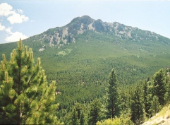 |
|||
| Trail Location: | Lily Lake Visitor Center | ||||
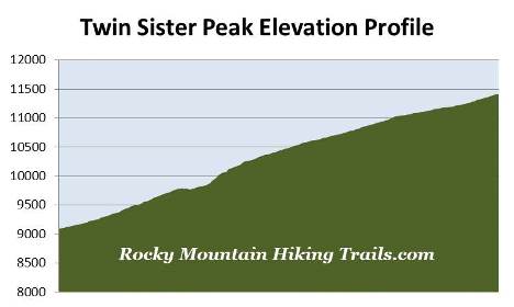
| Roundtrip Length: | 7.0 Miles | ||||
| Trailhead Elevation: | 9090 Feet | ||||
| Total Elevation Gain: | 2475 Feet | ||||
| Avg. Elev Gain / Mile: | 707 Feet | ||||
| Highest Elevation: | 11,428 Feet | ||||
| Trail Difficulty Rating: | 11.95 (strenuous) | ||||
| Parking Lot Latitude | 40.30288 | ||||
| Parking Lot Longitude | -105.53667 | ||||
Trail Description:
The hike to Twin Sisters Peak in Rocky Mountain National Park begins from the Twin Sisters Trailhead near Lily Lake. To reach the "new" Twin Sisters Trailhead from Estes Park, drive 6.3 miles south on Colorado Highway 7. Turn left (east) at the old Lily Lake Visitor Center (across the highway from Lily Lake), bypass the visitor center (now closed), and continue up the gravel road for less than a half-mile to reach the parking area just below a fence that blocks the road.
There are some people who use the hike up to Twin Sisters Peak as a warm-up hike, or to acclimate for other hikes in the park, such as the Keyhole on Longs Peak, or Hallett Peak in the Bear Lake area. However, it should be noted that Twin Sisters is a very worthy destination in and of itself. The views from the summit are quite outstanding.
 The hike begins by continuing along the gravel road above the fence. After walking roughly one-tenth of a mile you'll reach a trailhead kiosk on your left where the trail branches off from the road. After walking another short distance the trail exits Rocky Mountain National Park and enters Roosevelt National Forest. At roughly three-quarters of a mile from the parking area hikers will re-enter the park, and at one mile, will arrive at a small overlook that offers great views of Longs Peak and Estes Cone.
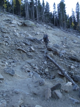
At roughly 1.3 miles hikers will reach a massive landslide area. This segment of the route is located in an area where the trail used to begin ascending a series of switchbacks. This enormous landslide, a result of the September 2013 flood, can be seen from Highway 7 (see nearby photo).
Unfortunately for hikers, the landslide washed out portions of three switchbacks along the route. In all, roughly 2000 feet of trail was impacted. Not long after the slide occurred, a social path was established to proceed through this section. As of late 2026, trail crews are finally making much-needed improvements to this section, which includes steps and a more defined route. Although the new route is a major improvement, once hikers cross over the landslide, the section that ascends along the south side of the washout is still very steep and strenuous.
During the historic storm of 2013, Estes Park received 9.4 inches of rain, while a rain gauge just south of Marys Lake reported 11.5 inches. The storm knocked out roads and bridges, stranded residents, and killed eight people in the Front Range area. Rocky Mountain National Park also received significant damage to roads, bridges and trails, which kept most of the park closed for nearly two weeks.
Beyond the landslide, as you proceed higher and the forest begins to thin, views of Longs Peak, Mt. Meeker, Powell Peak, Taylor Peak, Lily Mountain and Estes Cone will emerge towards the west. During this stretch hikers will exit the park and re-enter the national forest once again.
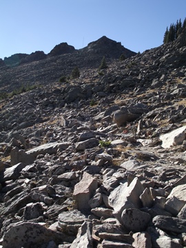
At 2.9 miles, and an elevation of roughly 11,000 feet, hikers will reach the tree line, at which point you'll have unobstructed views of the two Twin Sisters Peak summits (see photo above on the right). From here the terrain becomes progressively more rugged as you climb through relatively steep sections of talus and scree. You may want to consider bringing trekking poles for this segment.
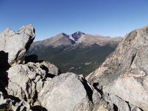
At roughly 3.4 miles the trail reaches the saddle between the east and west peaks. From here faint trails and cairns mark the relatively short routes to both summits. East Twin Sisters Peak, at 11,428 feet, is slightly higher than West Twin Sisters Peak, which tops out at 11,413. At the saddle is a stone hut building and a radio communications tower, both of which are apparently still used for locating lost hunters and downed aircraft. There was also an old fire lookout that once stood atop the western summit, but it was removed in 1977.
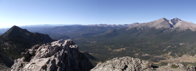
Though both peaks are accessible, it's much easier to ascend the western peak, thus making it the more popular destination. Once at the saddle you should veer to the right and head towards the stone hut. Just past the hut the trail immediately veers left and begins making the short ascent to the top. Although it's a little bit of a scramble to reach the summit, there's virtually no exposure to any steep drop-offs, and nothing that I would consider to be exceedingly dangerous. As long as you take your time you shouldn't have any issues along this short stretch.
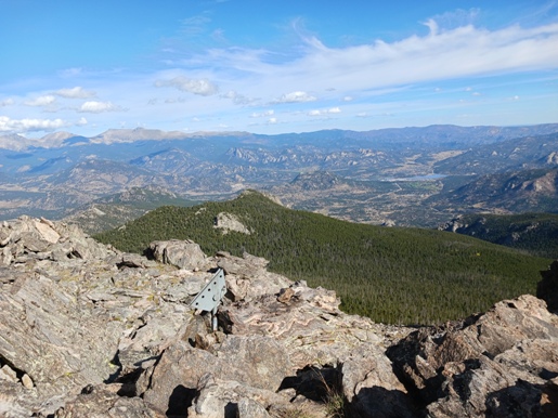
From the west summit hikers will enjoy commanding views of Longs Peak, Mt. Meeker, Estes Cone, the Continental Divide, and Estes Park towards the north.